2014
SZ0381 : Studland Hill
taken 10 years ago, near to Studland, Dorset, England
Studland Hill
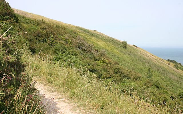
This is the steep south slope from the flat ridge of Ballard Down towards Swanage. The map names it as Studland Hill, even though Studland is to the north of Ballard Down.
 Map © Crown Copyright")
TIP: Click the map for more Large scale mapping
- Grid Square
- SZ0381, 111 images (more nearby 🔍)
- Photographer
- Anne Burgess (more nearby)
- Date Taken
- Wednesday, 2 July, 2014 (more nearby)
- Submitted
- Monday, 8 September, 2014
- Subject Location
-
OSGB36:
 SZ 0321 8114 [10m precision]
WGS84: 50:37.7970N 1:57.3586W - Camera Location
-
OSGB36: SZ 0302 8113
- View Direction
- EAST (about 90 degrees)