2014
SX3859 : Cattle near Cumble Tor
taken 10 years ago, near to Trematon, Cornwall, England
This is 1 of 2 images, with title Cattle near Cumble Tor in this square
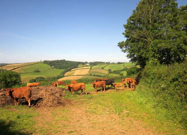
Cattle near Cumble Tor
From the same gateway as SX3859 : Cumble Tor View, looking to the right. Still a manure heap here eight years on. The fields beyond the cattle are across the Lynher, between Poldrissick and Treluggan.
 Map © Crown Copyright")
TIP: Click the map for more Large scale mapping
- Grid Square
- SX3859, 10 images (more nearby 🔍)
- Photographer
- Derek Harper (more nearby)
- Date Taken
- Saturday, 14 June, 2014 (more nearby)
- Submitted
- Wednesday, 10 September, 2014
- Subject Location
-
OSGB36:
 SX 3851 5920 [10m precision]
WGS84: 50:24.6251N 4:16.4485W - Camera Location
-
OSGB36: SX 3854 5920
- View Direction
- WEST (about 270 degrees)