2014
SH6455 : On Snowdon's Pyg Track
taken 10 years ago, 5 km S of Pont Pen-y-Benglog, Conwy, Wales
This is 1 of 3 images, with title On Snowdon's Pyg Track in this square
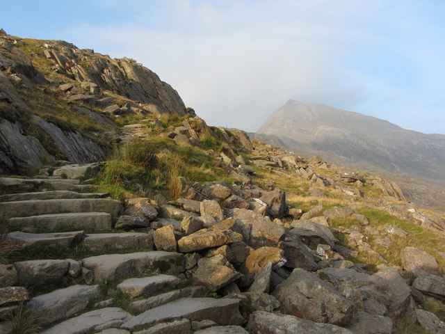
On Snowdon's Pyg Track
The peak visible is Crib Goch.
 Map © Crown Copyright")
TIP: Click the map for more Large scale mapping
- Grid Square
- SH6455, 210 images (more nearby 🔍)
- Photographer
- Gareth James (more nearby)
- Date Taken
- Friday, 12 September, 2014 (more nearby)
- Submitted
- Tuesday, 16 September, 2014
- Subject Location
-
OSGB36:
 SH 6447 5557 [10m precision]
WGS84: 53:4.8062N 4:1.4859W - Camera Location
-
OSGB36: SH 6449 5559
- View Direction
- West-southwest (about 247 degrees)