2014
SD8796 : Lover Gill
taken 10 years ago, near to Thwaite, North Yorkshire, England
This is 1 of 2 images, with title Lover Gill in this square
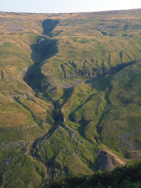
Lover Gill
Slanting September sunlight accentuates the myriad gullies and folds of this complex ravine, a tributary of Cliff Beck. Evidence of former lead mining activity can be seen in the spoil tip, bottom right. The right-slanting branch looks as if it may be an artificial 'hush', more evidence of past mining activity.
 Map © Crown Copyright")
TIP: Click the map for more Large scale mapping
- Grid Square
- SD8796, 83 images (more nearby 🔍)
- Photographer
- Karl and Ali (more nearby)
- Date Taken
- Tuesday, 16 September, 2014 (more nearby)
- Submitted
- Thursday, 18 September, 2014
- Subject Location
-
OSGB36:
 SD 8796 9630 [10m precision]
WGS84: 54:21.7247N 2:11.2073W - Camera Location
-
OSGB36: SD 8776 9665
- View Direction
- South-southeast (about 157 degrees)