2011
SN7319 : Rhiw Wen
taken 13 years ago, 3 km from Capel Gwynfe, Carmarthenshire/Sir Gaerfyrddin, Wales
Rhiw Wen
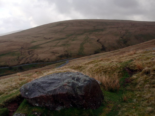
Carreg fawr ar Riw Wen uwchlaw'r A4069. Y bryn yn y pellter yw Cefn Truman.
A large boulder at Rhiw Wen (trans. fairhill) above the A4069. The hill in the distance is known as Cefn Truman (hillridge?).
A large boulder at Rhiw Wen (trans. fairhill) above the A4069. The hill in the distance is known as Cefn Truman (hillridge?).
 Map © Crown Copyright")
TIP: Click the map for more Large scale mapping
- Grid Square
- SN7319, 39 images (more nearby 🔍)
- Photographer
- Alan Richards (more nearby)
- Date Taken
- Sunday, 3 April, 2011 (more nearby)
- Submitted
- Saturday, 20 September, 2014
- Subject Location
-
OSGB36:
 SN 7349 1946 [10m precision]
WGS84: 51:51.5605N 3:50.3091W - Camera Location
-
OSGB36: SN 7342 1940
- View Direction
- Northeast (about 45 degrees)