2014
NO7056 : Rossie Spit in Montrose Basin
taken 10 years ago, near to Kirkton of Craig, Angus, Scotland
This is 1 of 2 images, with title starting with Rossie in this square
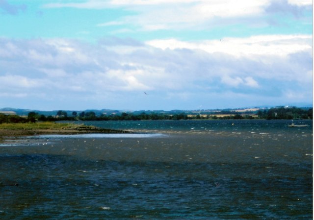
Rossie Spit in Montrose Basin
Rossie Spit is a finger shaped bank of mud and pebbles which have been deposited by the tidal currents in Montrose Basin. As the tide starts to fall, as in this photo, the water is starting to uncover the full extent of the spit. Because Rossie Spit is a much frequented site for a great variety of wading birds, the Scottish Wildlife Trust Visitor Centre has a camera permanently mounted there.
 Map © Crown Copyright")
TIP: Click the map for more Large scale mapping
- Grid Square
- NO7056, 117 images (more nearby 🔍)
- Photographer
- Andrew Diack (more nearby)
- Date Taken
- Sunday, 17 August, 2014 (more nearby)
- Submitted
- Sunday, 21 September, 2014
- Subject Location
-
OSGB36:
 NO 7032 5667 [10m precision]
WGS84: 56:42.0476N 2:29.1777W - Camera Location
-
OSGB36: NO 7062 5669
- View Direction
- WEST (about 270 degrees)