2014
SJ9694 : Godley Brook
taken 10 years ago, near to Gee Cross, Tameside, England
This is 1 of 7 images, with title Godley Brook in this square
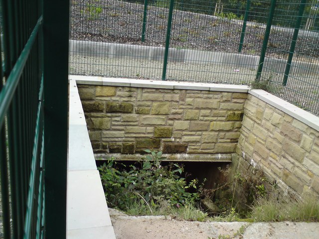
Godley Brook
The Godley Brook culverted under the recently built Kerry Way in the background. The footpath from Godley Hill has been diverted around it and heavily fenced.
View in opposite direction: SJ9694 : Godley Brook
View in opposite direction: SJ9694 : Godley Brook
 Map © Crown Copyright")
TIP: Click the map for more Large scale mapping
- Grid Square
- SJ9694, 228 images (more nearby 🔍)
- Photographer
- Gerald England (more nearby)
- Date Taken
- Monday, 22 September, 2014 (more nearby)
- Submitted
- Monday, 22 September, 2014
- Subject Location
-
OSGB36:
 SJ 9658 9499 [10m precision]
WGS84: 53:27.0995N 2:3.1779W - Camera Location
-
OSGB36: SJ 9658 9499
- View Direction
- WEST (about 270 degrees)