2014
NT5316 : Border Abbeys Way by Hornshole Bridge
taken 10 years ago, near to Cavers, Scottish Borders, Scotland
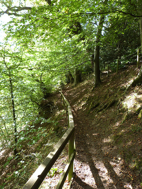
Border Abbeys Way by Hornshole Bridge
Here the Border Abbeys Way, a circular long-distance walking route in the Scottish Borders climbs high above the River Teviot.
 Map © Crown Copyright")
TIP: Click the map for more Large scale mapping
- Grid Square
- NT5316, 33 images (more nearby 🔍)
- Photographer
- Oliver Dixon (more nearby)
- Date Taken
- Monday, 22 September, 2014 (more nearby)
- Submitted
- Tuesday, 23 September, 2014
- Subject Location
-
OSGB36:
 NT 5329 1683 [10m precision]
WGS84: 55:26.5862N 2:44.3940W - Camera Location
-
OSGB36: NT 53324 16851
- View Direction
- West-southwest (about 247 degrees)