2014
SU8003 : Flood Defences, Bosham Harbour
taken 10 years ago, near to Bosham, West Sussex, England
This is 1 of 8 images, with title Flood Defences, Bosham Harbour in this square
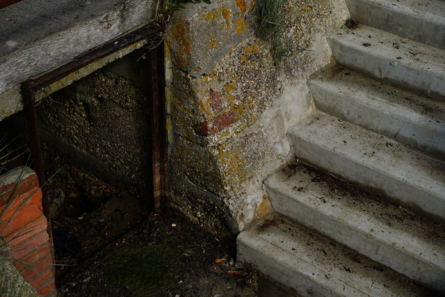
Flood Defences, Bosham Harbour
An extension to the previous flood defences, and about one foot (30cm) higher than the older adjacent defence wall. Here is the junction between the old and new defences, at a point where a drainage channel flows into the harbour. Note that, formerly, a board could be dropped into place; preventing the back-flow of water during flood conditions.
 Map © Crown Copyright")
TIP: Click the map for more Large scale mapping
- Grid Square
- SU8003, 440 images (more nearby 🔍)
- Photographer
- Peter Trimming (more nearby)
- Date Taken
- Wednesday, 24 September, 2014 (more nearby)
- Submitted
- Thursday, 25 September, 2014
- Subject Location
-
OSGB36:
 SU 8091 0392 [10m precision]
WGS84: 50:49.7503N 0:51.1522W - Camera Location
-
OSGB36: SU 8090 0391
- View Direction
- Northeast (about 45 degrees)