2014
SK3536 : Nottingham Road: evening sunlight on the Liversage almshouses
taken 10 years ago, near to Derby, England
This is 1 of 5 images, with title starting with Nottingham Road in this square
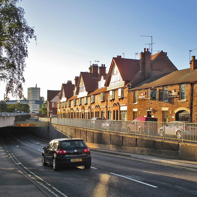
Nottingham Road: evening sunlight on the Liversage almshouses
Nottingham Road - once the A52 and the main road into Derby from the east - ducks under the St Alkmund's Way section of the inner ring road. The Derby in Pictures website outlines the history of the Liversage Trust's Nottingham Road estate: "One of the Trust's oldest land holdings is on Nottingham Road, possibly dating back to the 16th century. Today this area consists of a number of houses, a parade of shops and a couple of pubs and was mostly built in the 1890s to an arts and crafts style of design by local architect Alexander Macpherson. It replaced a smaller, older estate of which only a couple of buildings survive, notably The Peacock Inn of the 1700s and two stone cottages of a similar date. The estate is beautifully maintained by a small estate workforce who have an onsite workshop. The houses on this estate are still maintained as traditional almshouses providing accommodation for the elderly of the city who can show that they are in 'need, hardship or distress arising from their present housing circumstances'."
 Map © Crown Copyright")
TIP: Click the map for more Large scale mapping
- Grid Square
- SK3536, 1176 images (more nearby 🔍)
- Photographer
- John Sutton (more nearby)
- Date Taken
- Wednesday, 24 September, 2014 (more nearby)
- Submitted
- Thursday, 25 September, 2014
- Subject Location
-
OSGB36:
 SK 3564 3662 [10m precision]
WGS84: 52:55.5488N 1:28.2781W - Camera Location
-
OSGB36: SK 3570 3660
- View Direction
- West-northwest (about 292 degrees)