SP2965 : Sandstone exposure, entrance to former quarry off Wharf Street, Warwick
taken 10 years ago, near to Warwick, Warwickshire, England
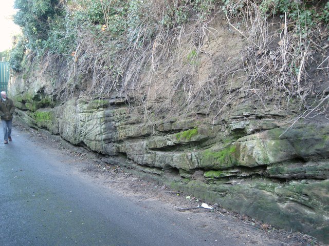
Coten End Quarry is a Geological Site of Special Scientific Interest. Natural England's site reference is 15WY5. The 1986 citation reads: "This site provides important exposures of fossiliferous sandstone layers of the Middle Triassic which accumulated about 230 million years ago, as sand dunes in a desert environment. Sandstones of this age in Britain are usually devoid of fossil remains but in this quarry geologists have found rare and important remains of reptiles and amphibians The fauna from Coten End is unique and varied, representing the broadest range of Middle Triassic reptiles in Britain and the best terrestrial fauna of the mid-Middle Triassic in the world." Vegetation was cleared after ownership changed in January 2010, revealing the sandstone exposures once more. The former quarry is a location for secure self-access storage units, operated by U Store. The western side of the quarry is in SP2865.
 Map © Crown Copyright")
- Grid Square
- SP2965, 1818 images (more nearby 🔍)
- Photographer
- Robin Stott (more nearby)
- Date Taken
- Thursday, 26 December, 2013 (more nearby)
- Submitted
- Thursday, 25 September, 2014
- Subject Location
-
OSGB36:
 SP 2904 6548 [10m precision]
WGS84: 52:17.2018N 1:34.5417W - Camera Location
-
OSGB36: SP 2905 6547
- View Direction
- West-northwest (about 292 degrees)