2014
SD9612 : The Pennine Bridleway descending to Cold Greave Clough
taken 10 years ago, near to Denshaw, Oldham, England
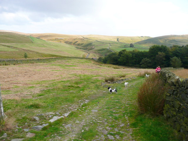
The Pennine Bridleway descending to Cold Greave Clough
 Map © Crown Copyright")
TIP: Click the map for more Large scale mapping
- Grid Square
- SD9612, 93 images (more nearby 🔍)
- Photographer
- Humphrey Bolton (more nearby)
- Date Taken
- Monday, 22 September, 2014 (more nearby)
- Submitted
- Friday, 26 September, 2014
- Subject Location
-
OSGB36:
 SD 9663 1295 [10m precision]
WGS84: 53:36.7853N 2:3.1447W - Camera Location
-
OSGB36: SD 9663 1295
- View Direction
- East-southeast (about 112 degrees)