2014
SD9612 : The Pennine Bridleway crossing Piethorne Clough
taken 10 years ago, near to Denshaw, Oldham, England
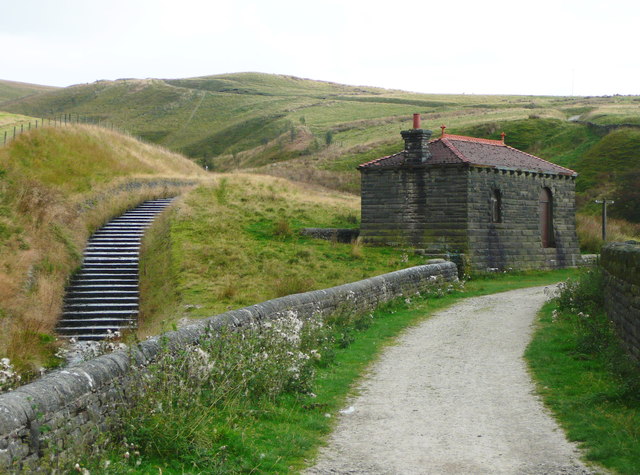
The Pennine Bridleway crossing Piethorne Clough
The steps are in the overflow channel from Norman Hill Reservoir. Piethorne reservoir is out of sight to the right.
 Map © Crown Copyright")
TIP: Click the map for more Large scale mapping
- Grid Square
- SD9612, 93 images (more nearby 🔍)
- Photographer
- Humphrey Bolton (more nearby)
- Date Taken
- Monday, 22 September, 2014 (more nearby)
- Submitted
- Friday, 26 September, 2014
- Subject Location
-
OSGB36:
 SD 9686 1276 [10m precision]
WGS84: 53:36.6830N 2:2.9360W - Camera Location
-
OSGB36: SD 9686 1276
- View Direction
- EAST (about 90 degrees)