2014
SD8371 : Boundary stones
taken 10 years ago, near to Horton in Ribblesdale, North Yorkshire, England
Boundary stones
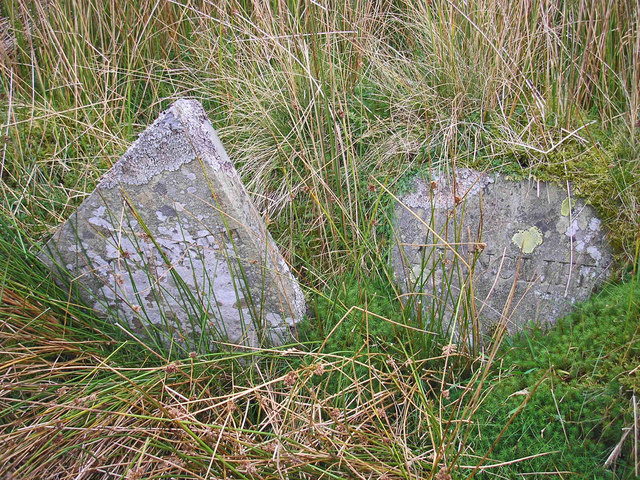
A parish boundary marker near Churn Milk Hole.
The stones say STAINFORTH and ARNCLIFFE but a visit with a strimmer is needed to get a clearer picture.
The stones say STAINFORTH and ARNCLIFFE but a visit with a strimmer is needed to get a clearer picture.
 Map © Crown Copyright")
TIP: Click the map for more Large scale mapping
- Grid Square
- SD8371, 49 images (more nearby 🔍)
- Photographer
- John Illingworth (more nearby)
- Date Taken
- Saturday, 27 September, 2014 (more nearby)
- Submitted
- Saturday, 27 September, 2014
- Subject Location
-
OSGB36:
 SD 8351 7183 [10m precision]
WGS84: 54:8.5222N 2:15.2348W - Camera Location
-
OSGB36: SD 8351 7183
- View Direction
- NORTH (about 0 degrees)