2014
NX4473 : On Crammery Hill 2
taken 10 years ago, 3 km from Auchinleck, Dumfries And Galloway, Scotland
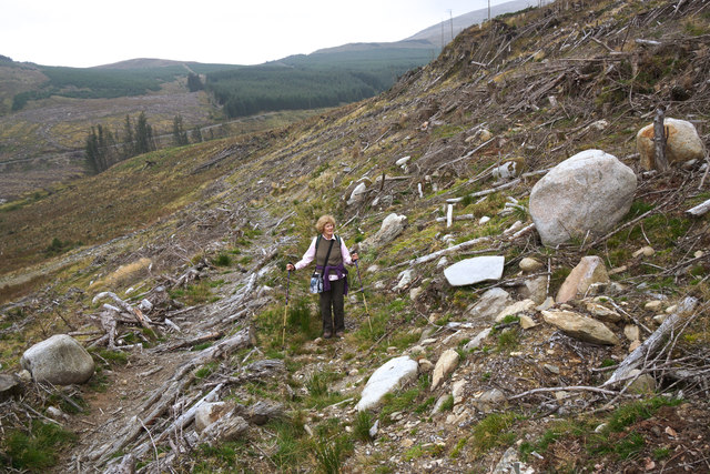
On Crammery Hill 2
No easy climb! Clear felling has made the going underfoot very difficult in places but the good news is that, had it not been for the forest clearances, this hillside would have been wholly inaccessible under a mantle of spruce.
 Map © Crown Copyright")
TIP: Click the map for more Large scale mapping
- Grid Square
- NX4473, 17 images (more nearby 🔍)
- Photographer
- Anthony O'Neil (more nearby)
- Date Taken
- Friday, 19 September, 2014 (more nearby)
- Submitted
- Monday, 29 September, 2014
- Subject Location
-
OSGB36:
 NX 4430 7388 [10m precision]
WGS84: 55:2.0990N 4:26.2706W - Camera Location
-
OSGB36: NX 4433 7388
- View Direction
- WEST (about 270 degrees)