SK7685 : Church of St Peter & St Paul, North Wheatley
taken 10 years ago, near to North Wheatley, Nottinghamshire, England
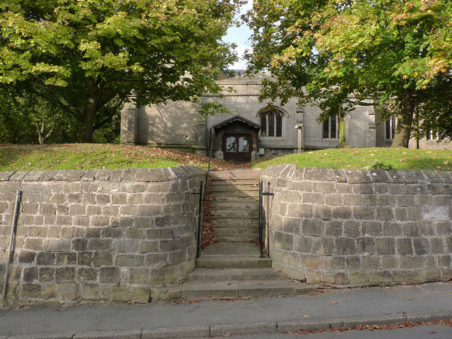
A simple church consisting of aisleless nave and chancel with 19th century vestry and a west tower. The nave is largely 15th century, as is the tower. The chancel was rebuilt in 1824, and the vestry added at this time. The exterior is generally unexceptional; the large west window in Perpendicular style is a 19th century insertion.
The interior contains several items of note. The font is a simple Norman tub font. Close to the font is an old hand-quern set into the wall, possibly to serve as a stoup. Also the remains of a Roman tombstone found in the churchyard in 1928. Ten of the bench ends are original early 15th century (attached to modern benches) with traceried panels and the remainder are 20th century copies. There is a small ogee-headed aumbry in the south wall of the nave. The pulpit is late Elizabethan in style, dating from 1604. The ladder-staircase up to the ringing chamber consists of rough-hewn oak steps attached to a pair of oak beams and may be medieval in original - certainly pre-19th century.
The south door is an unusual triangular arch without curves of early 16th century origin.
The church is Listed Grade II*. For more information see Link
Listed buildings and structures are officially designated as being of special architectural, historical or cultural significance. There are over half a million listed structures in the United Kingdom, covered by around 375,000 listings.
Listed status is more commonly associated with buildings or groups of buildings, however it can cover many other structures, including bridges, headstones, steps, ponds, monuments, walls, phone boxes, wrecks, parks, and heritage sites, and in more recent times a road crossing (Abbey Road) and graffiti art (Banksy 'Spy-booth') have been included.
In England and Wales there are three main listing designations;
Grade I (2.5%) - exceptional interest, sometimes considered to be internationally important.
Grade II* (5.5%) - particularly important buildings of more than special interest.
Grade II (92%) - nationally important and of special interest.
There are also locally listed structures (at the discretion of local authorities) using A, B and C designations.
In Scotland three classifications are also used but the criteria are different. There are around 47,500 Listed buildings.
Category A (8%)- generally equivalent to Grade I and II* in England and Wales
Category B (51%)- this appears generally to cover the ground of Grade II, recognising national importance.
Category C (41%)- buildings of local importance, probably with some overlap with English Grade II.
In Northern Ireland the criteria are similar to Scotland, but the classifications are:
Grade A (2.3%)
Grade B+ (4.7%)
Grade B (93%)
Read more at Wikipedia Link
 Map © Crown Copyright")
- Grid Square
- SK7685, 101 images (more nearby 🔍)
- Photographer
- Alan Murray-Rust (more nearby)
- Date Taken
- Sunday, 28 September, 2014 (more nearby)
- Submitted
- Saturday, 4 October, 2014
- Subject Location
-
OSGB36:
 SK 7620 8584 [10m precision]
WGS84: 53:21.8369N 0:51.3828W - Camera Location
-
OSGB36: SK 7620 8583
- View Direction
- NORTH (about 0 degrees)