2014
NS2071 : Mist over Inverkip
taken 10 years ago, near to Langhouse, Inverclyde, Scotland
This is 1 of 11 images, with title Mist over Inverkip in this square
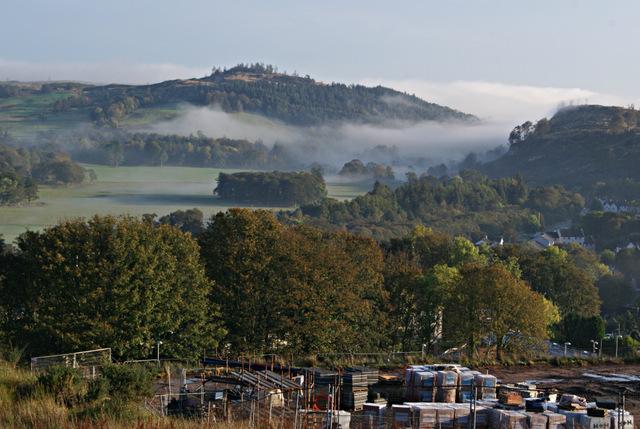
Mist over Inverkip
Bargane Hill is on the left, Idzholm Hill on the right. Viewed from the building site south of Inverkip railway station.
 Map © Crown Copyright")
TIP: Click the map for more Large scale mapping
- Grid Square
- NS2071, 691 images (more nearby 🔍)
- Photographer
- Thomas Nugent (more nearby)
- Date Taken
- Tuesday, 7 October, 2014 (more nearby)
- Submitted
- Saturday, 11 October, 2014
- Subject Location
-
OSGB36:
 NS 2049 7177 [10m precision]
WGS84: 55:54.3276N 4:52.3907W - Camera Location
-
OSGB36: NS 2042 7168
- View Direction
- Northeast (about 45 degrees)