2013
TQ3181 : Cutler's Hall, London, EC2
taken 11 years ago, near to City of London, The City of London, England
This is 1 of 2 images, with title Cutler's Hall, London, EC2 in this square
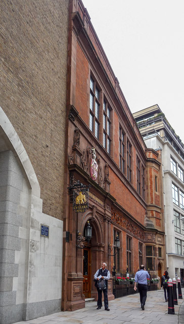
Cutler's Hall, London, EC2
The present Hall was built on land in Warwick Lane, which had been the site of the Royal College of Physicians from 1674 to 1825 and subsequently a foundry. The new Hall was designed by Mr. T. Tayler Smith, the Companys Surveyor, and came into use on March 7th 1888. It is the fifth Cutlers' Hall.
On 10 May 1941 the adjoining building was destroyed and the present hall was badly damaged, losing the entire north wall. The building was restored and by 1951 was back in full use.
Link
On 10 May 1941 the adjoining building was destroyed and the present hall was badly damaged, losing the entire north wall. The building was restored and by 1951 was back in full use.
Link
 Map © Crown Copyright")
TIP: Click the map for more Large scale mapping
- Grid Square
- TQ3181, 4257 images (more nearby 🔍)
- Photographer
- Christine Matthews (more nearby)
- Date Taken
- Thursday, 12 September, 2013 (more nearby)
- Submitted
- Sunday, 12 October, 2014
- Subject Location
-
OSGB36:
 TQ 318 813 [100m precision]
WGS84: 51:30.9154N 0:6.1170W - Camera Location
-
OSGB36: TQ 3184 8131
- View Direction
- NORTH (about 0 degrees)