2014
NY2659 : Hadrian's Wall Walk Day 1 - Bowness on Solway to Carlisle 2
taken 10 years ago, near to Drumburgh, Cumbria, England
Hadrian's Wall Walk Day 1 - Bowness on Solway to Carlisle 2
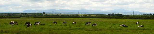
The Solway Firth coastal flatlands viewed from the Hadrian's Wall Path east of Drumburgh. Away in the hazy distance are the fells of Skiddaw Forest.
 Map © Crown Copyright")
TIP: Click the map for more Large scale mapping
- Grid Square
- NY2659, 34 images (more nearby 🔍)
- Photographer
- Bobby Clegg (more nearby)
- Date Taken
- Tuesday, 17 June, 2014 (more nearby)
- Submitted
- Tuesday, 14 October, 2014
- Subject Location
-
OSGB36:
 NY 2678 5968 [10m precision]
WGS84: 54:55.5847N 3:8.6434W - Camera Location
-
OSGB36: NY 2675 5976
- View Direction
- South-southeast (about 157 degrees)