2014
TQ9169 : The Swale (2)
taken 10 years ago, near to Iwade, Kent, England
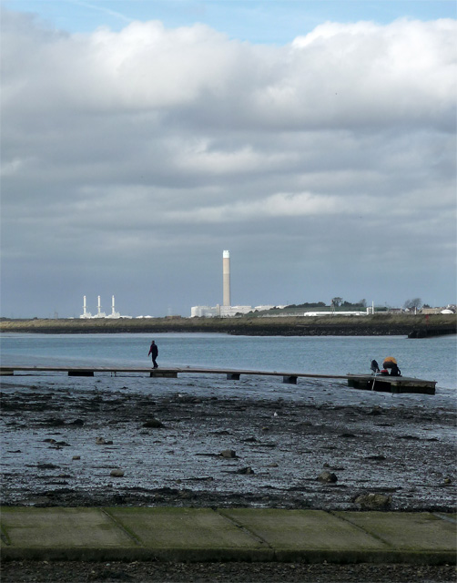
The Swale (2)
Looking north under the Sheppey Crossing towards the now-closed Grain Power Station.
The men were attempting to catch fish by sticking a metal hook in their mouths.
The men were attempting to catch fish by sticking a metal hook in their mouths.
 Map © Crown Copyright")
TIP: Click the map for more Large scale mapping
- Grid Square
- TQ9169, 160 images (more nearby 🔍)
- Photographer
- Stephen Richards (more nearby)
- Date Taken
- Saturday, 18 October, 2014 (more nearby)
- Submitted
- Thursday, 23 October, 2014
- Subject Location
-
OSGB36:
 TQ 9131 6938 [10m precision]
WGS84: 51:23.4722N 0:44.9006E - Camera Location
-
OSGB36: TQ 91346 69271
- View Direction
- North-northwest (about 337 degrees)