TM2736 : Heavy Anti-Aircraft Emplacement
taken 9 years ago, near to Trimley st Mary, Suffolk, England
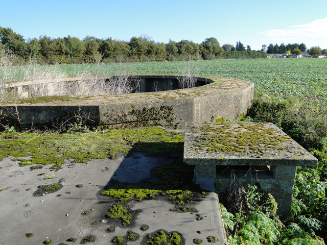
Along the East Anglian coastline, as elsewhere in the British Isles, a number of WWII coastal anti-invasion defences remain more or less intact. Between Felixstowe and The Wash, a large number of these were hastily constructed in 1940, necessitated by the imminent invasion by Nazi Germany (Operation Sealion). Out of an estimated 28,000 only just over 6,000 survive.
Many are hidden from view; others have now become part of the landscape, some put to other uses.
The defences take various forms, the most commonly seen is the pillbox, (sometimes called a blockhouse) these themselves come in many forms: usually having four, five or six facets. The most common being the hexagonal shape with a blast wall protecting the entrance. The embrasures differ too, from small to large and varying in number in each wall. Occasionally a narrow slit along the whole of the wall facing the invader is the only opening although these are usually observation posts. Other defences can also still be found, tank-traps, great square concrete blocks, and some pyramidal called dragons teeth were in the 1950s a common sight on the side of a strategic road. Most if not all these have been removed. The Royal Observer Corps had many installations too, some looking quite like pillboxes but with a completely different operational role.
Today they are nothing more than permanent monuments and a silent tribute to the courage and tenacity of the British people during the uncertainty of the early 1940s when Britain stood alone against Nazi Germany.
See also Linkand Link
 Map © Crown Copyright")
- Grid Square
- TM2736, 44 images (more nearby 🔍)
- Photographer
- Adrian S Pye (more nearby)
- Date Taken
- Saturday, 25 October, 2014 (more nearby)
- Submitted
- Saturday, 25 October, 2014
- Subject Location
-
OSGB36:
 TM 2767 3615 [10m precision]
WGS84: 51:58.6286N 1:18.8166E - Camera Location
-
OSGB36: TM 2766 3613
- View Direction
- North-northeast (about 22 degrees)