2014
SE0127 : Path onto Wadsworth Moor
taken 10 years ago, near to Mytholmroyd, Calderdale, England
This is 1 of 2 images, with title Path onto Wadsworth Moor in this square
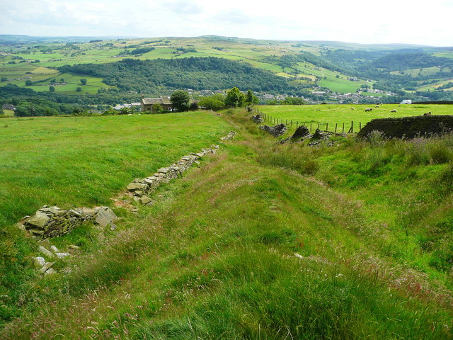
Path onto Wadsworth Moor
This strip of access land cannot decide whether it is a sunken lane or a valley. I suspect that it is an old route for driving livestock onto the moor and became worn down so that the land on each side drained into it and eroded it further.
 Map © Crown Copyright")
TIP: Click the map for more Large scale mapping
- Grid Square
- SE0127, 160 images (more nearby 🔍)
- Photographer
- Humphrey Bolton (more nearby)
- Date Taken
- Monday, 7 July, 2014 (more nearby)
- Submitted
- Saturday, 25 October, 2014
- Subject Location
-
OSGB36:
 SE 0160 2715 [10m precision]
WGS84: 53:44.4438N 1:58.6333W - Camera Location
-
OSGB36: SE 0160 2715
- View Direction
- SOUTH (about 180 degrees)