2014
NY5016 : Phone box and village green, Burnbanks
taken 9 years ago, near to Bampton, Cumbria, England
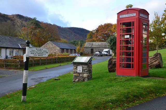
Phone box and village green, Burnbanks
Burnbanks was built as a model village in the late 1920s by Manchester Corporation to house workers on the Haweswater reservoir construction project. The information board explains that this was a self-contained community with shop, dispensary, mission, dance hall and an expanded school at Bampton, the nearest village. The dam was completed in 1940 and supplies Manchester with water flowing under gravity via a 100 mile long aqueduct.
The sign indicates the fellside track along the lake to Mardale Head.
The sign indicates the fellside track along the lake to Mardale Head.
 Map © Crown Copyright")
TIP: Click the map for more Large scale mapping
- Grid Square
- NY5016, 30 images (more nearby 🔍)
- Photographer
- Jim Barton (more nearby)
- Date Taken
- Friday, 24 October, 2014 (more nearby)
- Submitted
- Monday, 27 October, 2014
- Subject Location
-
OSGB36:
 NY 5077 1608 [10m precision]
WGS84: 54:32.2549N 2:45.7421W - Camera Location
-
OSGB36: NY 5079 1610
- View Direction
- Southwest (about 225 degrees)