2014
TL5503 : The former King's Head, High Street, CM5
taken 10 years ago, near to Chipping Ongar, Essex, England
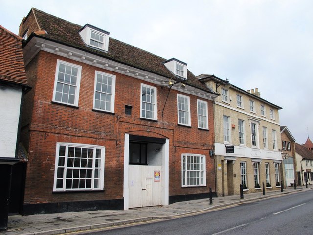
The former King's Head, High Street, CM5
The building is Grade II listed Link (Archive Link ) . The pub's sign (The King's Inn) is on the other side of the street TL5503 : Shops in the High Street, Chipping Ongar (2).
 Map © Crown Copyright")
TIP: Click the map for more Large scale mapping
- Grid Square
- TL5503, 181 images (more nearby 🔍)
- Photographer
- Mike Quinn (more nearby)
- Date Taken
- Wednesday, 24 September, 2014 (more nearby)
- Submitted
- Monday, 27 October, 2014
- Subject Location
-
OSGB36:
 TL 5525 0303 [10m precision]
WGS84: 51:42.2722N 0:14.7216E - Camera Location
-
OSGB36: TL 5527 0302
- View Direction
- West-northwest (about 292 degrees)