1961
SH6166 : Carnedd peaks in Snowdonia from Bethesda, 1961
taken 63 years ago, near to Bethesda, Gwynedd, Wales
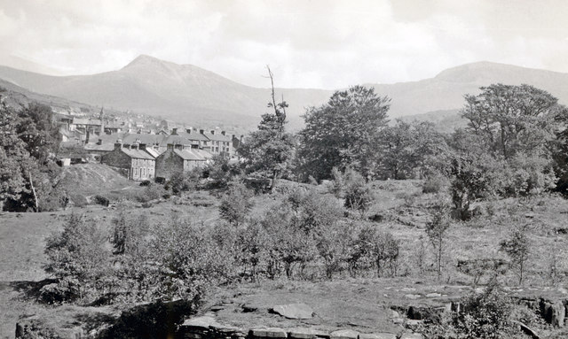
Carnedd peaks in Snowdonia from Bethesda, 1961
View SE from by the site of former railway station by the Afon Ogwen: Carnedd Llewelyn (3,485 ft.) is on the left, Carnedd Dafydd (3,427 ft.) on the right.
 Map © Crown Copyright")
TIP: Click the map for more Large scale mapping
- Grid Square
- SH6166, 80 images (more nearby 🔍)
- Photographer
- Ben Brooksbank (more nearby)
- Date Taken
- 20 May 1961 (more nearby)
- Submitted
- Saturday, 1 November, 2014
- Subject Location
-
OSGB36:
 SH 618 668 [100m precision]
WGS84: 53:10.8298N 4:4.1041W - Camera Location
-
OSGB36: SH 618 668
- View Direction
- Southeast (about 135 degrees)