2014
SH1525 : Kettle hole
taken 9 years ago, near to Bodermid, Gwynedd, Wales
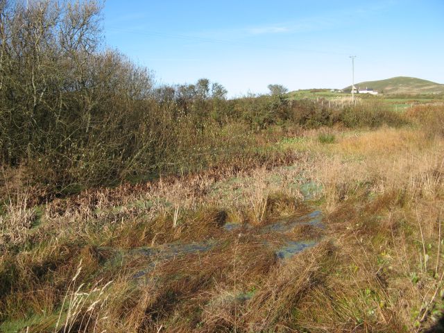
Kettle hole
I was mystified by this isolated wetland without any obvious inlet or outlet, but subsequent reference to the geological map shows that it is identified by the British Geological Survey as a kettle hole, and there is another just to the west. A kettle hole originates as a block of stagnant ice in deposits of till, which when melted creates a void which fills with water and mobile sediment. As the formation is likely to be clay-rich they are well-sealed, excellent ponds. Mynydd Anelog forms the distant skyline.
 Map © Crown Copyright")
TIP: Click the map for more Large scale mapping
- Grid Square
- SH1525, 29 images (more nearby 🔍)
- Photographer
- Jonathan Wilkins (more nearby)
- Date Taken
- Wednesday, 29 October, 2014 (more nearby)
- Submitted
- Saturday, 8 November, 2014
- Subject Location
-
OSGB36:
 SH 1501 2518 [10m precision]
WGS84: 52:47.5434N 4:44.7002W - Camera Location
-
OSGB36: SH 1501 2518
- View Direction
- NORTH (about 0 degrees)