2014
SK9913 : History of Pickworth
taken 9 years ago, near to Pickworth, Rutland, England
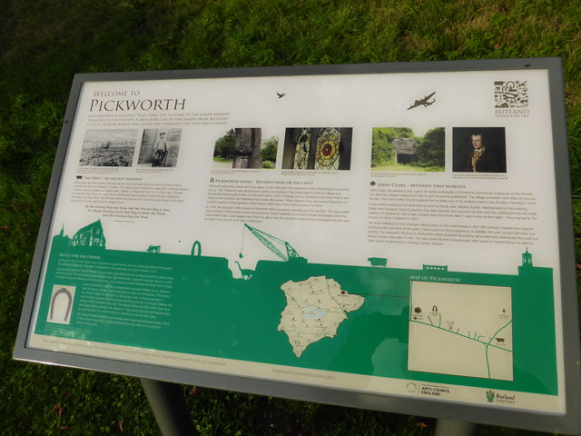
History of Pickworth
Rutland County Council has been erecting these historic interpretation boards in many villages. They are interesting, but one could hardly call this one complete. It does, unusually, mention the Drift, the ancient drove road along the valley, but seems to omit the battle of Losecoat Field.
Nevertheless, well done Rutland!
Nevertheless, well done Rutland!
 Map © Crown Copyright")
TIP: Click the map for more Large scale mapping
- Grid Square
- SK9913, 80 images (more nearby 🔍)
- Photographer
- Bob Harvey (more nearby)
- Date Taken
- Sunday, 9 November, 2014 (more nearby)
- Submitted
- Monday, 10 November, 2014
- Subject Location
-
OSGB36:
 SK 9921 1380 [10m precision]
WGS84: 52:42.7666N 0:31.9713W - Camera Location
-
OSGB36: SK 9921 1380
- View Direction
- North-northwest (about 337 degrees)