2014
SJ2736 : NW boundary of Weston Rhyn
taken 10 years ago, near to Weston Rhyn, Shropshire, England
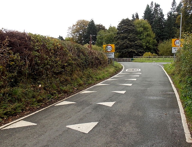
NW boundary of Weston Rhyn
The National Speed Limit on this side reduces to 30mph in Weston Rhyn, a village in NW Shropshire.
 Map © Crown Copyright")
TIP: Click the map for more Large scale mapping
- Grid Square
- SJ2736, 18 images (more nearby 🔍)
- Photographer
- Jaggery (more nearby)
- Date Taken
- Thursday, 16 October, 2014 (more nearby)
- Submitted
- Saturday, 15 November, 2014
- Subject Location
-
OSGB36:
 SJ 2797 3601 [10m precision]
WGS84: 52:54.9997N 3:4.3606W - Camera Location
-
OSGB36: SJ 2796 3602
- View Direction
- Southeast (about 135 degrees)