2014
TA1828 : Church Lane, Hedon, Yorkshire
taken 9 years ago, near to Hedon, East Riding of Yorkshire, England
This is 1 of 2 images, with title Church Lane, Hedon, Yorkshire in this square
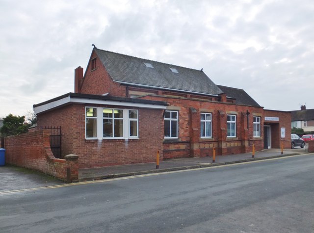
Church Lane, Hedon, Yorkshire
Hedon Methodist Church was built 1926, with later additions, to replace that destroyed by bombing in the 1914-18 War.
 Map © Crown Copyright")
TIP: Click the map for more Large scale mapping
- Grid Square
- TA1828, 730 images (more nearby 🔍)
- Photographer
- Bernard Sharp (more nearby)
- Date Taken
- Thursday, 20 November, 2014 (more nearby)
- Submitted
- Friday, 21 November, 2014
- Subject Location
-
OSGB36:
 TA 1879 2854 [10m precision]
WGS84: 53:44.3831N 0:12.0265W - Camera Location
-
OSGB36: TA 1877 2857
- View Direction
- Southeast (about 135 degrees)