2014
TQ3358 : St Luke, Whyteleafe: benchmark
taken 9 years ago, near to Whyteleafe, Surrey, England
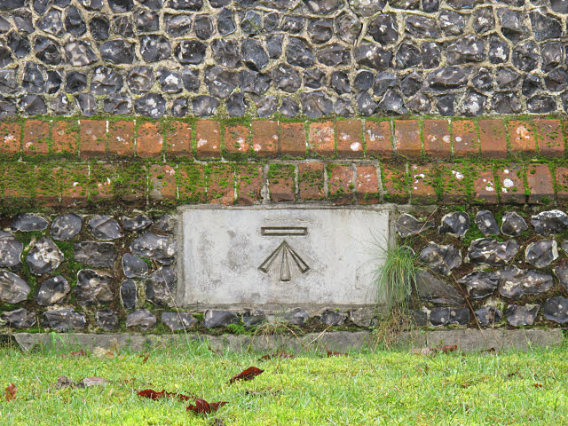
St Luke, Whyteleafe: benchmark
The benchmark is set into the east wall of the church TQ3358 : St Luke, Whyteleafe: east end.
St Luke's church, Whyteleafe
A small Anglican parish church in the suburb of Whyteleafe south of Croydon. Built in 1864 with later additions including the "transept" (parish room) of 1968 by Frank Senior and the west porch of 1981 by P G Kennedy.
The church is notable mainly for its historical connection with the Battle of Britain. Many of the planes that fought the battle flew from nearby Kenley Aerodrome, the church was the first in England to be damaged by a German bomb, several airmen are buried in the churchyard, and a complete roll of the aircrew who took part in the battle is kept in the church.
 Map © Crown Copyright")
TIP: Click the map for more Large scale mapping
- Grid Square
- TQ3358, 107 images (more nearby 🔍)
- Photographer
- Stephen Craven (more nearby)
- Date Taken
- Monday, 24 November, 2014 (more nearby)
- Submitted
- Wednesday, 26 November, 2014
- Subject Location
-
OSGB36:
 TQ 3374 5828 [10m precision]
WGS84: 51:18.4759N 0:4.9609W - Camera Location
-
OSGB36: TQ 3374 5828
- View Direction
- West-southwest (about 247 degrees)