2014
SJ8864 : Pearson Bridge north-east of Buglawton, Cheshire
taken 10 years ago, near to Eaton, Cheshire East, England
This is 1 of 2 images, with title Pearson Bridge north-east of Buglawton, Cheshire in this square
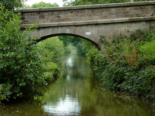
Pearson Bridge north-east of Buglawton, Cheshire
This section of the canal is heavily overshadowed by mature trees. Pasture is on both sides. Pearson Bridge, No 64, is an accommodation bridge linking the pastures and carries no public right of way.
There has been comment in the boating fraternity this year (2014) that the recently formed Canal and River Trust is not clearing vegetation growth from canal sides as efficiently as did the former British Waterways, especially by bridges. The Macclesfield Canal in particular has been mentioned.
There has been comment in the boating fraternity this year (2014) that the recently formed Canal and River Trust is not clearing vegetation growth from canal sides as efficiently as did the former British Waterways, especially by bridges. The Macclesfield Canal in particular has been mentioned.
 Map © Crown Copyright")
TIP: Click the map for more Large scale mapping
- Grid Square
- SJ8864, 20 images (more nearby 🔍)
- Photographer
- Roger D Kidd (more nearby)
- Date Taken
- Thursday, 4 September, 2014 (more nearby)
- Submitted
- Thursday, 27 November, 2014
- Subject Location
-
OSGB36:
 SJ 8811 6495 [10m precision]
WGS84: 53:10.8909N 2:10.7621W - Camera Location
-
OSGB36: SJ 8810 6493
- View Direction
- North-northeast (about 22 degrees)