2014
NT9638 : Farmland at Barmoor Ridge
taken 9 years ago, near to Ford, Northumberland, England
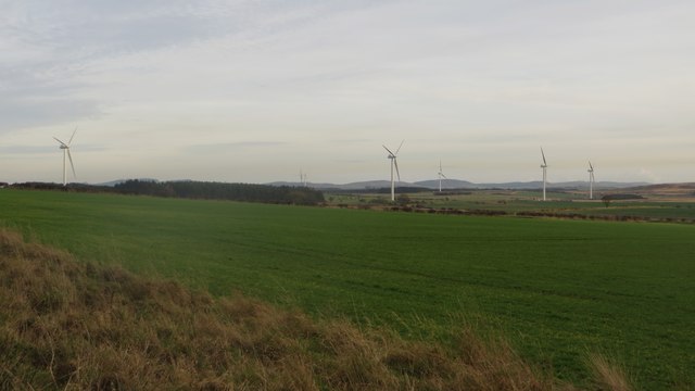
Farmland at Barmoor Ridge
A winter cereal crop is growing on the arable land in the foreground. In the distance all 6 of the newly erected turbines of Barmoor Wind Farm can be seen.
 Map © Crown Copyright")
TIP: Click the map for more Large scale mapping
- Grid Square
- NT9638, 21 images (more nearby 🔍)
- Photographer
- Graham Robson (more nearby)
- Date Taken
- Tuesday, 25 November, 2014 (more nearby)
- Submitted
- Thursday, 27 November, 2014
- Subject Location
-
OSGB36:
 NT 9648 3886 [10m precision]
WGS84: 55:38.5965N 2:3.4492W - Camera Location
-
OSGB36: NT 96459 38880
- View Direction
- East-southeast (about 112 degrees)