SP2055 : Lock 55, Stratford-upon-Avon Canal
taken 9 years ago, near to Stratford-Upon-Avon, Warwickshire, England
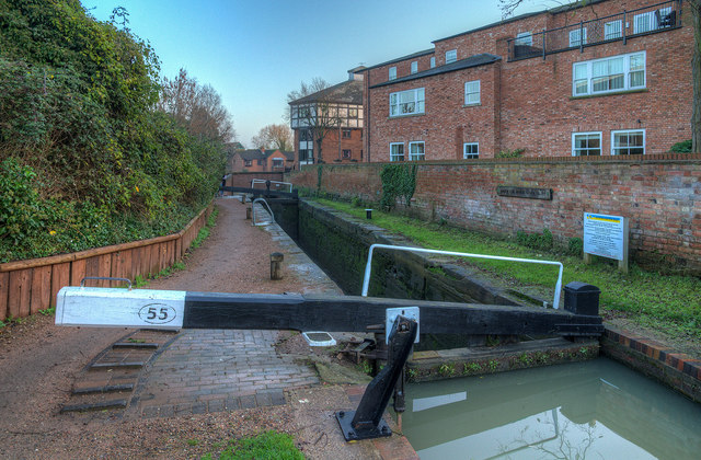
The white sign to the right informs boat owners that passing through the next lock, No. 56, onto the River Avon, requires a licence from the Avon Navigation Trust.
The Stratford-upon-Avon Canal links the Worcester and Birmingham Canal at King's Norton Junction with the River Avon at Stratford. The canal is 25·5 miles long, and has 56 locks*, the last onto the river being a broad lock. The canal was built in several stages (including changes of route) from 1793 on, finally opening fully to the River Avon in 1815. Multiple changes of ownership followed leading to the Great Western Railway taking control by 1863.
By the 1950s the section north of Lapworth was rarely being used, and the southern section from Lapworth was badly silted with some unusable locks. It is believed that the last boat reached Stratford in the early 1930s, though a pleasure cruiser reached Wilmcote at Easter in 1947.
Threat of total closure of the southern section in the mid 1950s caused protests, leading to an enquiry in 1958, and a big public campaign to save the canal, so the abandonment plans were reversed in 1959.
The National Trust took on the task of restoring the southern section of the canal in 1960, leading to its re-opening by Queen Elizabeth, the Queen Mother on 11 July 1964. Control was passed to the British Waterways Board in 1988, then to the Canal and River Trust in 2012.
*One stop-lock at King's Norton is unused and open, another at Kingswood Junction is duplicated.
(Details reduced from Nicholson's Waterways Guide No 2)
 Map © Crown Copyright")
- Grid Square
- SP2055, 404 images (more nearby 🔍)
- Photographer
- David P Howard (more nearby)
- Date Taken
- Saturday, 29 November, 2014 (more nearby)
- Submitted
- Saturday, 29 November, 2014
- Subject Location
-
OSGB36:
 SP 2036 5517 [10m precision]
WGS84: 52:11.6637N 1:42.2136W - Camera Location
-
OSGB36: SP 2035 5518
- View Direction
- Southeast (about 135 degrees)