2014
SD5908 : Narrowboat Moored on the Leeds and Liverpool Canal near Sennicar Bridge
taken 9 years ago, near to Red Rock, Wigan, England
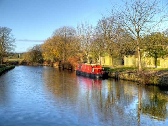
Narrowboat Moored on the Leeds and Liverpool Canal near Sennicar Bridge
The Leeds and Liverpool Canal is the longest canal in Northern England at 127 miles long. The first of the trans-Pennine canals it took 46 years to build at a cost of five times the original budget, mainly because of the length and complexity of the route. It passes through 91 locks with a summit level of 487 feet at Foulridge near Nelson and Colne. It was originally conceived in the 18th century to carry woollen goods from Leeds and Bradford and limestone from Skipton but in its 19th century heyday it carried stone, coal and many other goods. The impact of the railways was not as great as with other canals and commercial traffic continued along the main canal until 1964. Regular work stopped in 1972 when the movement of coal to Wigan Power Station ceased. In the latter part of the 20th century the leisure potential of the canal was developed and it is now a popular destination for cruising, fishing, walking and cycling. See Link for detailed information.
See other images of Leeds and Liverpool Canal
See other images of Leeds and Liverpool Canal
 Map © Crown Copyright")
TIP: Click the map for more Large scale mapping
- Grid Square
- SD5908, 47 images (more nearby 🔍)
- Photographer
- David Dixon (more nearby)
- Date Taken
- Sunday, 30 November, 2014 (more nearby)
- Submitted
- Sunday, 30 November, 2014
- Subject Location
-
OSGB36:
 SD 5901 0873 [10m precision]
WGS84: 53:34.4136N 2:37.2286W - Camera Location
-
OSGB36: SD 5901 0868
- View Direction
- NORTH (about 0 degrees)