NT2347 : Restoration work, Great Polish Map of Scotland (4)
taken 9 years ago, near to Eddleston, Scottish Borders, Scotland
See the Map website at Link
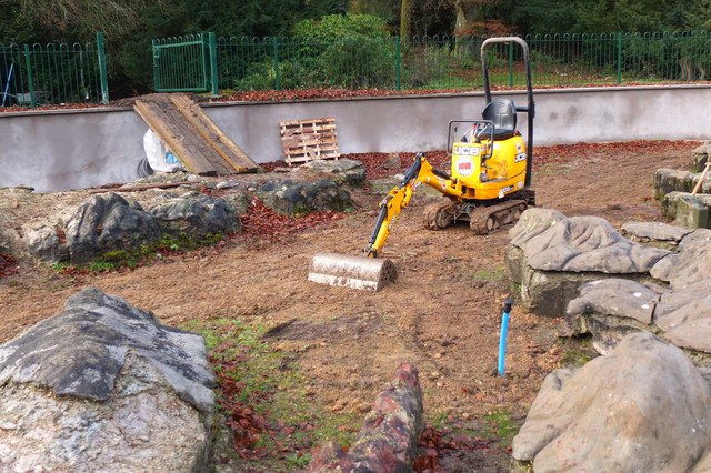
A relief map of Scotland built in the grounds of Barony Castle Hotel at Eddleston. After WWII many Polish soldiers found it difficult to return home and many remained in Britain. One who stayed in Scotland was the Commander, General Maczek. After the war, the Barony Hotel was bought by of one of his former soldiers, Jan Tomasik, and together they decided to create a great Map of Scotland in memory of the hospitality of its people and Polands part in its defence, on the site of the tactical map they had once made on the old putting green. It was built in a few weeks in 1975 by a small team of young Polish geographers. After Jan Tomasiks death the hotel changed hands and the Great Polish Map fell into decay. It was cleaned up and stabilised by the hotel staff, but restoration to its original glory seemed unlikely, but in 2008 a team of volunteers drew up proposals for its restoration. Some initial clearing work has been done, there is the possibility of Lottery Funding and negotiations for a lease on the site are almost complete [summer 2013]. It is hoped eventually that the sea and lochs will also be restored. It shows up well on Google Earth.
A summary of the work done on the Great Polish Map of Scotland, Barony Castle Hotel, Eddleston
Grateful thanks to Keith Burns for this list.
Commissioned: Jan Tomasik, Barony Castle Hotel owner
Designed and built: Dr Kasimierz Trafas and team, 1975 1979
Abandoned 1980
Rediscovered late 1990s
Mapa Scotland restoration campaign launched, 2010
Debris and vegetation clearance started, 2010
Mapa Scotland Charity established June 2012
Main funding in place, November 2013
2014 2017
Restoration works and heritage research started, February 2014
Safety fence installed, pit wall repaired and rendered
250 tonnes of debris removed
200m of underground pipework replaced and seabed sealed with bentonite
All insecure foundations of rusty cans and rubble replaced by frost resistant concrete and mortar
New viewing tower designed and built
Heritage Lottery and Leader Fund completion audits cleared, January 2017
Map development and heritage promotion continue, February 2017
Featured at European Heritage Conference in Krakow, June 2017
Foundation and topography repairs completed, August 2017
34 tonnes of concrete & mortar used
Surface stabilisation, protection and painting completed, October 2017
Major grant providers for restoration:
Barony Castle Hotel LLP
Consulate General of the Republic of Poland, Edinburgh.
European Leader Fund.
Heritage Lottery Fund
Historic Environment Scotland Support Fund
Landfill Communities Fund
Maczek Memorial Trust
Polish Connections Scotland
Polish Foreign Ministry
Scottish Polish Cultural Association
Scottish Borders Council
Wojtek Trust
You, the public
Volunteers The Mapa Scotland squad, The Royal Highland Fusiliers 2nd Battalion Royal Regiment of Scotland, EDF Torness, Royal Bank of Scotland, Local scouts, cubs and brownies
 Map © Crown Copyright")
- Grid Square
- NT2347, 267 images (more nearby 🔍)
- Photographer
- Jim Barton (more nearby)
- Date Taken
- Sunday, 30 November, 2014 (more nearby)
- Submitted
- Saturday, 6 December, 2014
- Subject Location
-
OSGB36:
 NT 2364 4716 [10m precision]
WGS84: 55:42.7101N 3:13.0131W - Camera Location
-
OSGB36: NT 2364 4716
- View Direction
- West-northwest (about 292 degrees)