2007
NU1735 : Fields Inshore of The Wynding
taken 17 years ago, near to Bamburgh, Northumberland, England
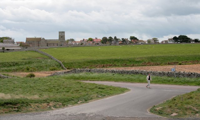
Fields Inshore of The Wynding
Looking from The Wynding across Mill Burn to Bamburgh and St. Aidan's church.
 Map © Crown Copyright")
TIP: Click the map for more Large scale mapping
- Grid Square
- NU1735, 251 images (more nearby 🔍)
- Photographer
- Mick Garratt (more nearby)
- Date Taken
- Monday, 7 May, 2007 (more nearby)
- Submitted
- Tuesday, 8 May, 2007
- Subject Location
-
OSGB36:
 NU 177 350 [100m precision]
WGS84: 55:36.5188N 1:43.1980W - Camera Location
-
OSGB36: NU 178 354
- View Direction
- South-southwest (about 202 degrees)