2014
TF5176 : Huttoft: aerial 2014
taken 9 years ago, near to Huttoft, Lincolnshire, England
This is 1 of 2 images, with title Huttoft: aerial 2014 in this square
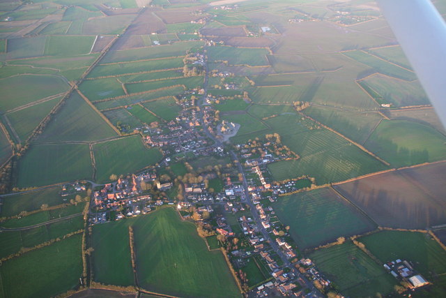
Huttoft: aerial 2014
In the strange light of a December afternoon.
The disused Sutton Branch Line (railway, now mostly a walkway) runs past on the left. See: TF5177 : From Huttoft to the sea on the Sutton Branch Line: aerial 2014 and TF5178 : The Sutton Branch Line Walkway.
For aerial films of this area see: Link and Link
These are LiDAR films of the Wolds and Marshes east of Louth. The films are narrated by Jim Broadbent. The land is colour-coded according to its elevation. The films show how the landscape was reclaimed for salt making and grazing. Footage includes ancient river systems, settlements, salterns and ridge and furrow. Produced for the Lincolnshire Coastal Grazing Marshes Project, which has now terminated.
The disused Sutton Branch Line (railway, now mostly a walkway) runs past on the left. See: TF5177 : From Huttoft to the sea on the Sutton Branch Line: aerial 2014 and TF5178 : The Sutton Branch Line Walkway.
For aerial films of this area see: Link
These are LiDAR films of the Wolds and Marshes east of Louth. The films are narrated by Jim Broadbent. The land is colour-coded according to its elevation. The films show how the landscape was reclaimed for salt making and grazing. Footage includes ancient river systems, settlements, salterns and ridge and furrow. Produced for the Lincolnshire Coastal Grazing Marshes Project, which has now terminated.
 Map © Crown Copyright")
TIP: Click the map for more Large scale mapping
- Grid Square
- TF5176, 53 images (more nearby 🔍)
- Photographer
- Chris (more nearby)
- Date Taken
- Saturday, 6 December, 2014 (more nearby)
- Submitted
- Monday, 8 December, 2014
- Subject Location
-
OSGB36:
 TF 5130 7651 [10m precision]
WGS84: 53:15.8408N 0:16.0199E - Camera Location
-
OSGB36: TF 5130 7549
- View Direction
- NORTH (about 0 degrees)