2002
NH5821 : Creag a' Chliabhain
taken 22 years ago, 3 km from Errogie, Highland, Scotland
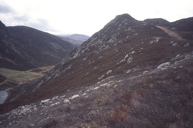
Creag a' Chliabhain
The northeast ridge and narrow glen which separates Creag a' Chliabhain from the main mass of the Monadhliath.
 Map © Crown Copyright")
TIP: Click the map for more Large scale mapping
- Grid Square
- NH5821, 9 images (more nearby 🔍)
- Photographer
- Richard Webb (more nearby)
- Date Taken
- Monday, 1 April, 2002 (more nearby)
- Submitted
- Sunday, 14 December, 2014
- Subject Location
-
OSGB36:
 NH 5833 2121 [10m precision]
WGS84: 57:15.5725N 4:21.0190W - Camera Location
-
OSGB36: NH 5843 2131
- View Direction
- Southwest (about 225 degrees)