2014
SO2718 : Trig point on the summit of Sugar Loaf
taken 9 years ago, near to Forest Coal Pit, Monmouthshire/Sir Fynwy, Wales
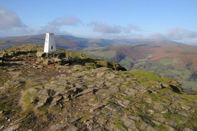
Trig point on the summit of Sugar Loaf
The mountains in the background are the Black Mountains and include: Pen Cerrig-calch, Pen Gloch-y-pibwr and Pen Allt-mawr. To the right, and in cloud is Waun Fach, at around 800m the highest point in the Black Mountains range.
 Map © Crown Copyright")
TIP: Click the map for more Large scale mapping
- Grid Square
- SO2718, 134 images (more nearby 🔍)
- Photographer
- Philip Halling (more nearby)
- Date Taken
- Saturday, 13 December, 2014 (more nearby)
- Submitted
- Wednesday, 17 December, 2014
- Subject Location
-
OSGB36:
 SO 2724 1876 [10m precision]
WGS84: 51:51.7595N 3:3.4811W - Camera Location
-
OSGB36: SO 2725 1875
- View Direction
- North-northwest (about 337 degrees)