2014
SM7327 : Wartime Ruins on Carn Llidi
taken 9 years ago, near to Treleddyd-Fawr, Pembrokeshire/Sir Benfro, Wales
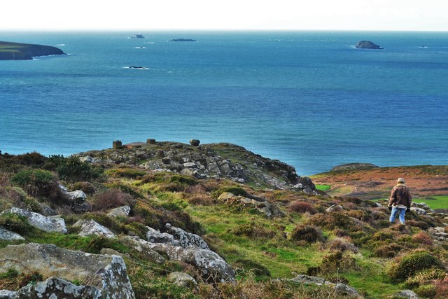
Wartime Ruins on Carn Llidi
This consists of the remains of a concrete base and two concrete square cubes with pathways around it. This is the higher of the two installations
 Map © Crown Copyright")
TIP: Click the map for more Large scale mapping
- Grid Square
- SM7327, 239 images (more nearby 🔍)
- Photographer
- Deborah Tilley (more nearby)
- Date Taken
- Thursday, 25 December, 2014 (more nearby)
- Submitted
- Sunday, 28 December, 2014
- Subject Location
-
OSGB36:
 SM 7357 2789 [10m precision]
WGS84: 51:54.2049N 5:17.5777W - Camera Location
-
OSGB36: SM 7361 2793
- View Direction
- Southwest (about 225 degrees)