2014
SO9737 : Track to Beckford
taken 9 years ago, near to Conderton, Worcestershire, England
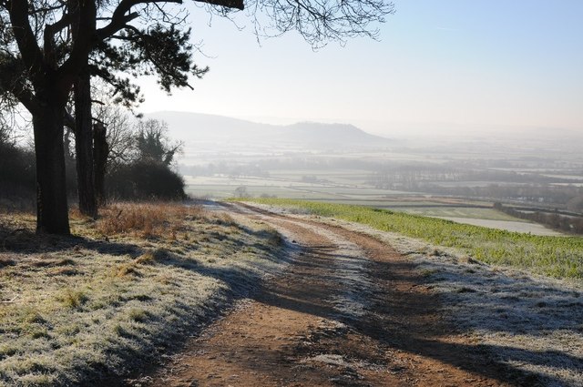
Track to Beckford
Pictured on a frosty December morning a track ascending Bredon Hill, though this area of the hill is known as Conderton Hill. The track and bridleway rises from the village of Beckford to the south. Below, partially obscured in the mist is the vale to the east of the Severn, with Oxenton Hill just visible on the horizon.
 Map © Crown Copyright")
TIP: Click the map for more Large scale mapping
- Grid Square
- SO9737, 40 images (more nearby 🔍)
- Photographer
- Philip Halling (more nearby)
- Date Taken
- Monday, 29 December, 2014 (more nearby)
- Submitted
- Saturday, 3 January, 2015
- Subject Location
-
OSGB36:
 SO 9745 3773 [10m precision]
WGS84: 52:2.2780N 2:2.3152W - Camera Location
-
OSGB36: SO 9745 3774
- View Direction
- South-southwest (about 202 degrees)