2005
HU3489 : Pettadale Water
taken 19 years ago, near to Sandvoe, Mainland, Shetland Islands, Scotland
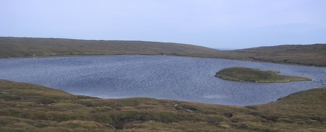
Pettadale Water
Small shallow loch with abundant wild brown trout. Pettadale, meaning Picts valley. Island mound.
 Map © Crown Copyright")
TIP: Click the map for more Large scale mapping
- Grid Square
- HU3489 (more nearby 🔍)
- Photographer
- Robert Sandison (more nearby)
- Date Taken
- Saturday, 3 September, 2005 (more nearby)
- Submitted
- Saturday, 12 May, 2007
- Subject Location
-
OSGB36:
 HU 342 898 [100m precision]
WGS84: 60:35.4329N 1:22.6522W - Camera Location
-
OSGB36: HU 341 896
- View Direction
- NORTH (about 0 degrees)