2014
TF1468 : Tupholme Abbey
taken 10 years ago, near to Southrey, Lincolnshire, England
This is 1 of 8 images, with title Tupholme Abbey in this square
Tupholme Abbey
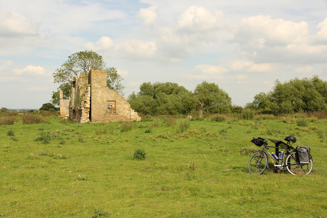
Abbey ruins and site of fishponds from the footpath
Tupholme Abbey
The Premonstratensian Abbey at Tupholme was founded by Gilbert and Alan de Neville between 1155 and 1165. It was never a prosperous house and was suppressed in the first wave of dissolutions in 1536, passing to the Heneage family of Hainton. It passed through the Heneage, Willoughby and Vyner families until about 1700 when the Vyners demolished all but the surviving wall as an eyecatcher in the Parkland to Tupholme Hall. The ruins became a farmstead in the 18th & 19th centuries before dereliction in the 1970s. It is now in the care of The Heritage Trust for Lincolnshire as a grade I listed building and Scheduled Ancient Monument
 Map © Crown Copyright")
TIP: Click the map for more Large scale mapping
- Grid Square
- TF1468, 50 images (more nearby 🔍)
- Photographer
- Richard Croft (more nearby)
- Date Taken
- Thursday, 12 June, 2014 (more nearby)
- Submitted
- Sunday, 11 January, 2015
- Subject Location
-
OSGB36:
 TF 1439 6820 [10m precision]
WGS84: 53:11.9150N 0:17.3438W - Camera Location
-
OSGB36: TF 1435 6820
- View Direction
- EAST (about 90 degrees)