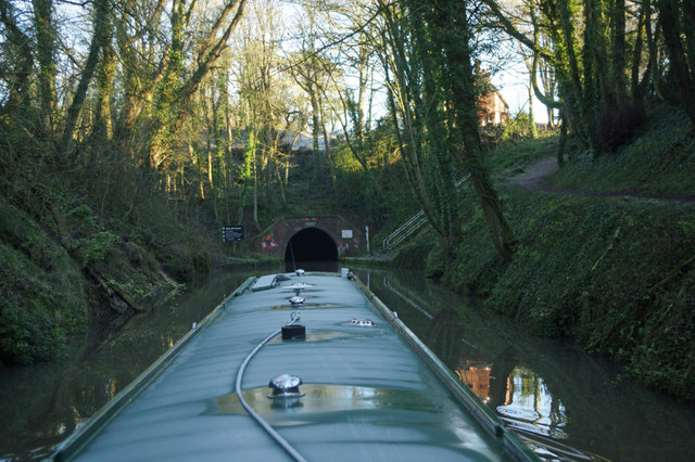
SP0375 : Approaching Wast Hills Tunnel
taken 9 years ago, near to Hopwood, Worcestershire, England
The Worcester and Birmingham Canal was built in stages between 1791 and 1815 to connect the River Severn in Worcester to the Birmingham Canal System using a quicker route than the earlier Staffordshire and Worcestershire Canal. Opposition from other canal companies meant that for twenty years there was no direct connection in Birmingham, the last two and a bit metres of canal there being left uncompleted in 1795. Link

This lunacy was eventually resolved by an Act of Parliament in 1815 and a stop-lock constructed.
Grain, timber and agricultural produce were carried to the Midlands. Industrial goods and coal were carried down towards Worcester, often for onward transport to Bristol. Later, salt carrying was added as a regular cargo. Pairs of donkeys were often used in preference to horses, maybe because they could easily be put onto the boats which had to be legged (or pulled by tug) through the tunnels.
The canal has five tunnels. The longest at Kings Norton is just under two miles long. Steam tugs were used from the 1870s to haul strings of narrowboats through Wasts Hill, Shortwood and Tardebigge tunnels. The Worcester and Birmingham Canal has locks, 58 of them, climbing 428 feet (130 metres) from the level of the River Severn in Worcester up to Birmingham.
In the twenty-first century the ring now formed by the two canals and the river makes a popular two weeks holiday route, albeit partly a strenuous one, lockwise, but there are plenty of pubs, though some are now merely restaurants with a bar. The Worcester and Birmingham Canal travels through some very pleasant countryside, climbing from the Severn through rolling fields and wooded cuttings and slicing through a hilly ridge south of Birmingham.
Link
 Map © Crown Copyright")
- Grid Square
- SP0375, 59 images (more nearby 🔍)
- Photographer
- Stephen McKay (more nearby)
- Date Taken
- Monday, 29 December, 2014 (more nearby)
- Submitted
- Thursday, 15 January, 2015
- Subject Location
-
OSGB36:
 SP 035 758 [100m precision]
WGS84: 52:22.8351N 1:56.9387W - Camera Location
-
OSGB36: SP 035 757
- View Direction
- North-northeast (about 22 degrees)