2015
NS7258 : Under the Dry Brig
taken 9 years ago, near to Bothwell, South Lanarkshire, Scotland
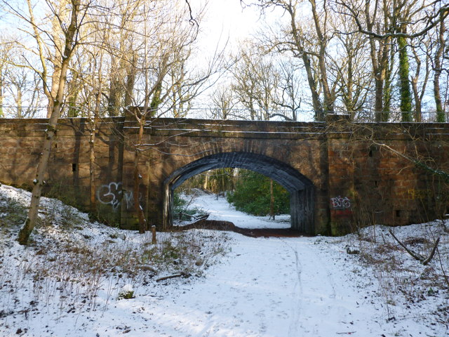
Under the Dry Brig
This old bridge carried one estate track over another - a 19th Century map suggests that the track over the top belonged to the Orbiston (Douglas Park) Estate with the one below belonging to the Bogs Estate.
 Map © Crown Copyright")
TIP: Click the map for more Large scale mapping
- Grid Square
- NS7258, 53 images (more nearby 🔍)
- Photographer
- Alan O'Dowd (more nearby)
- Date Taken
- Sunday, 18 January, 2015 (more nearby)
- Submitted
- Monday, 19 January, 2015
- Subject Location
-
OSGB36:
 NS 7246 5835 [10m precision]
WGS84: 55:48.0927N 4:2.1731W - Camera Location
-
OSGB36: NS 7245 5834
- View Direction
- Northeast (about 45 degrees)