2014
SE0626 : Bridleway to Ramsden Wood Farm
taken 10 years ago, near to Mount Tabor, Calderdale, England
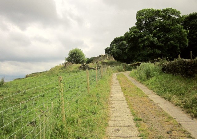
Bridleway to Ramsden Wood Farm
The ruins of the farm are ahead, where the bridleway swings right. Behind is Ramsden Wood.
 Map © Crown Copyright")
TIP: Click the map for more Large scale mapping
- Grid Square
- SE0626, 137 images (more nearby 🔍)
- Photographer
- Derek Harper (more nearby)
- Date Taken
- Thursday, 3 July, 2014 (more nearby)
- Submitted
- Friday, 23 January, 2015
- Subject Location
-
OSGB36:
 SE 0605 2694 [10m precision]
WGS84: 53:44.3286N 1:54.5855W - Camera Location
-
OSGB36: SE 0603 2697
- View Direction
- South-southeast (about 157 degrees)