2015
SS4622 : Map and description board for Rolle Canal inclined plane
taken 9 years ago, near to Landcross, Devon, England
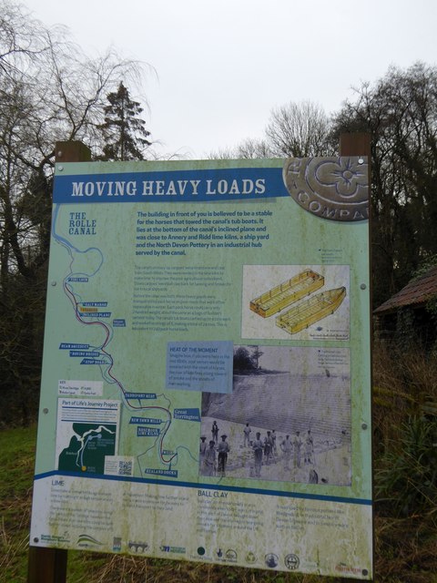
Map and description board for Rolle Canal inclined plane
Part of the waymarked path that follows the route of the 19th century canal
 Map © Crown Copyright")
TIP: Click the map for more Large scale mapping
- Grid Square
- SS4622, 70 images (more nearby 🔍)
- Photographer
- David Smith (more nearby)
- Date Taken
- Friday, 23 January, 2015 (more nearby)
- Submitted
- Monday, 26 January, 2015
- Subject Location
-
OSGB36:
 SS 4631 2248 [10m precision]
WGS84: 50:58.8696N 4:11.4479W - Camera Location
-
OSGB36: SS 4632 2248
- View Direction
- WEST (about 270 degrees)