2009
SJ7948 : Bridge carrying former railway over farm track
taken 15 years ago, near to Halmer End, Staffordshire, England
This is 1 of 2 images, with title Bridge carrying former railway over farm track in this square
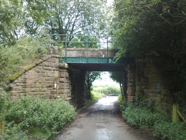
Bridge carrying former railway over farm track
This was part of the North Staffordshire Railway line between Alsager and Keele. It lost its passenger services to bus competition in 1931, and the line closed to all traffic in January 1963.
Link is a wintry view of the same scene.
Link is a wintry view of the same scene.
The Audley branch railway
The 'Audley branch', between Alsager Junction and Keele, closed to passenger traffic in April 1931, and to all traffic in January 1963. The section between Alsager and Merelake has been designated the 'Merelake Way', and is managed by Cheshire East Council. The stretch between Bignall End and Halmer End is a popular walking and dog-exercising route, and is always referred to locally as 'the lines'.
An account of the line's history is at Link.
 Map © Crown Copyright")
TIP: Click the map for more Large scale mapping
- Grid Square
- SJ7948, 216 images (more nearby 🔍)
- Photographer
- Jonathan Hutchins (more nearby)
- Date Taken
- Sunday, 19 July, 2009 (more nearby)
- Submitted
- Wednesday, 28 January, 2015
- Subject Location
-
OSGB36:
 SJ 792 487 [100m precision]
WGS84: 53:2.1103N 2:18.6531W - Camera Location
-
OSGB36: SJ 792 486
- View Direction
- Northwest (about 315 degrees)