1981
NF7973 : Malacleit/North Uist - 1981
taken 43 years ago, near to Malacleit, North Uist & Berneray, Na h-Eileanan an Iar, Scotland
Malacleit/North Uist - 1981
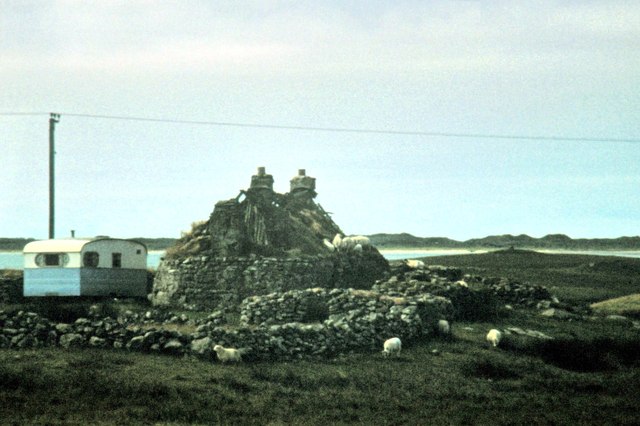
Malacleit, North Uist, Western Isles aka Outer Hebrides, A865 Sollas, Tràigh Bhàlaigh, derelict Cottage near Struan Cottage
 Map © Crown Copyright")
TIP: Click the map for more Large scale mapping
- Grid Square
- NF7973, 24 images (more nearby 🔍)
- Photographer
- Helmut Zozmann (more nearby)
- Date Taken
- August 1981 (more nearby)
- Submitted
- Saturday, 7 February, 2015
- Subject Location
-
OSGB36:
 NF 7935 7369 [10m precision]
WGS84: 57:38.3170N 7:22.5348W - Camera Location
-
OSGB36: NF 79364 73648
- View Direction
- NORTH (about 0 degrees)