2015
TR3140 : Demolition site, Dover Western Docks
taken 9 years ago, near to Dover, Kent, England
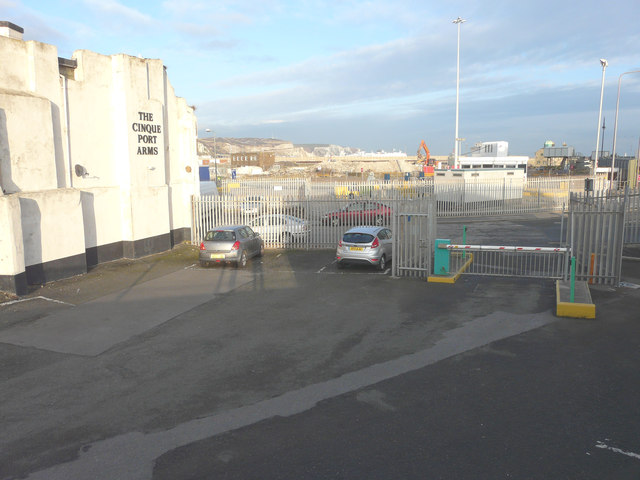
Demolition site, Dover Western Docks
Compared with TR3140 : Demolition of buildings, Dover Western Docks, all traces of the buildings have disappeared. This view was taken from The Viaduct.
 Map © Crown Copyright")
TIP: Click the map for more Large scale mapping
- Grid Square
- TR3140, 785 images (more nearby 🔍)
- Photographer
- John Baker (more nearby)
- Date Taken
- Friday, 30 January, 2015 (more nearby)
- Submitted
- Tuesday, 17 February, 2015
- Subject Location
-
OSGB36:
 TR 3179 4041 [10m precision]
WGS84: 51:6.9643N 1:18.6279E - Camera Location
-
OSGB36: TR 3175 4036
- View Direction
- Northeast (about 45 degrees)